Drawing on 15 years of voluntary residential well water testing data he had collected from throughout Sheboygan County, Kevin used GIS to map the results for nitrate, chloride, and arsenic. The maps may be helpful in determining whether there are any “hot spots” for these contaminants. Further, when other mapping layers are added, such as busy road intersections, it may be possible, for example, to identify a correlation between the presence of high chloride results with the heavy use of road salt.
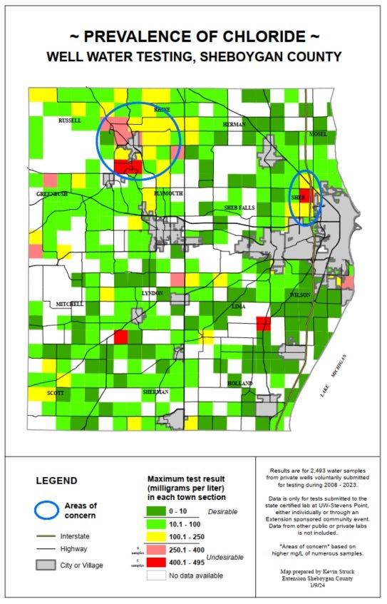
Map showing prevalence of chloride in private wells tested in Sheboygan County from 2008 through 2023. Highest concentrations are located near Elkhart Lake and near Interstate 43 corridor in Town of Sheboygan.
After recently receiving the message below, Kevin responded by sending the draft ordinance and application he had created for a project with a town in Sheboygan County.
“Just read your Accessory Dwelling Unit in Rural Areas presentation for Sheboygan County, and really enjoyed it. We are in the process of having a local Land Use Ordinance, Short-Term Rental Ordinance, and ADU Ordinance with reviewing our Comprehensive Plan. Do you know if any municipalities have adopted ADU ordinance that we can mark up?” – Supervisor on the Town of Draper Board in Sawyer County, Wisconsin